Days 51-52 (23rd to 24th September) – Briançon & Briançon to Briançon and Barcelonnette.
23rd September – A rest day in historic Briançon, the highest (1,326 m) city in France. A chance to wander about its well-preserved UNESCO World Heritage fortifications known as the Cité Vauban.
Inhabited since Roman times when it was known as Brigantium, Briançon sits at the confluence of five river valleys, which historically has made it a strategically important trade route and critical defence point against invasions.
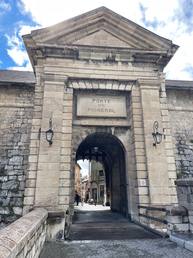
The impressive fortifications were designed by the renowned military engineer and architect Sébastien Le Prestre de Vauban and built between 1692 and 1723.
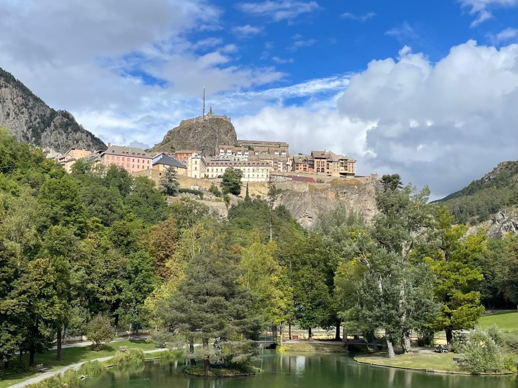
The fortified part of the city sits high on the hill offering commanding views in multiple directions.
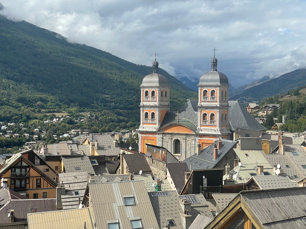
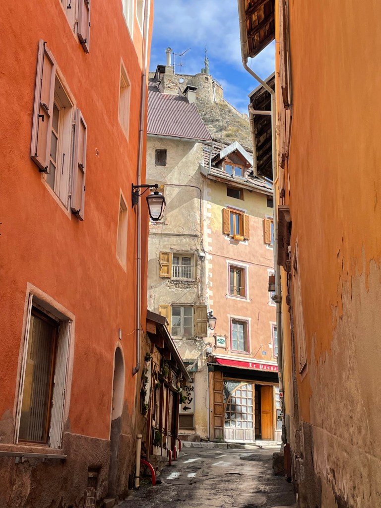
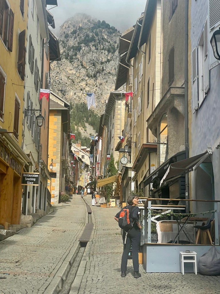
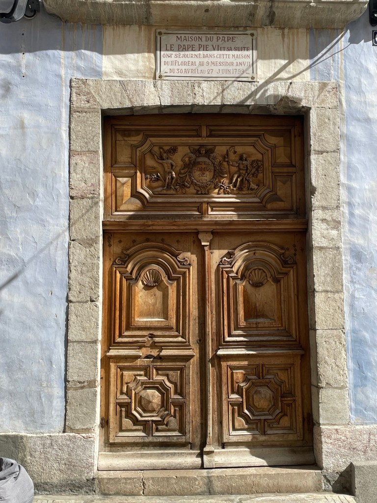
Briançon is also listed as a Ville d’Art et Histoire (City of Art and History). Multi-coloured facades, little squares, fountains, frescoes and sculpted wooden doors greet us as we stroll along the Grande Rue, the central artery of the old town.

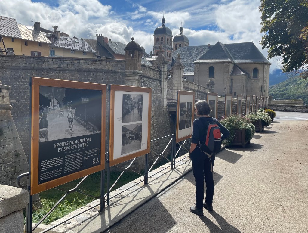
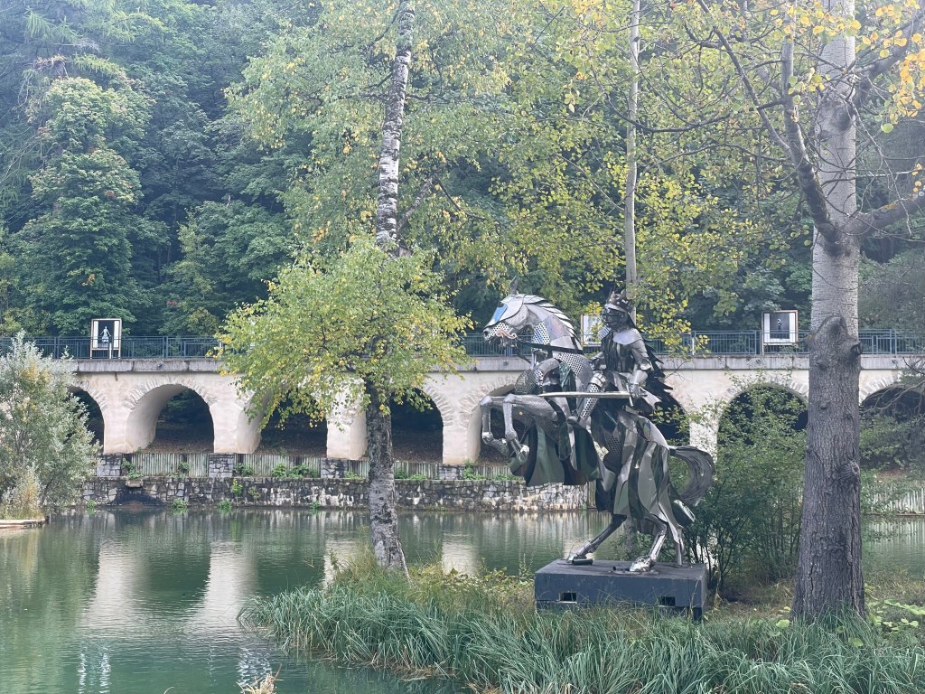
The city below the city is also impressive.
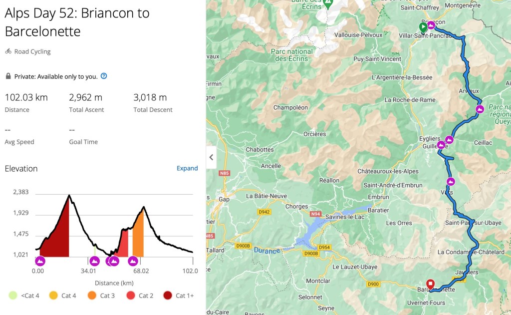
24th September – The intention was to ride 100km to Barcelonnette via the Cols d’Izoard and the de Vars.
It didn’t quite work out that way.
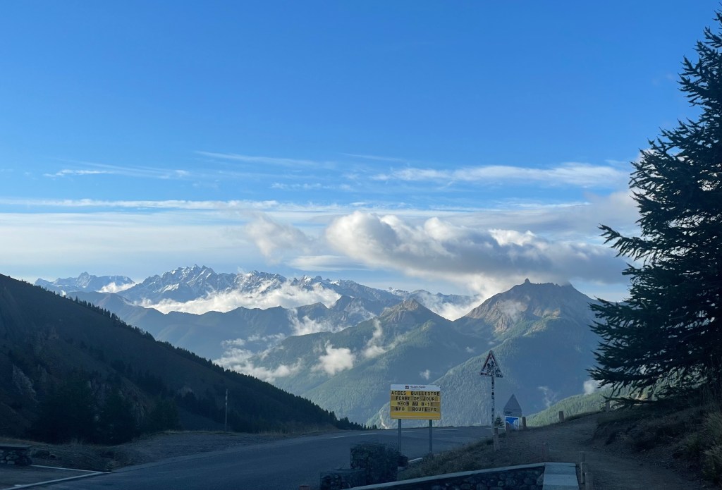
On the outskirts of town, as we started our climb, there was a sign with what looked like notice that the road to Guillestre (part of our route) was closed. It couldn’t be so. Google maps showed it to be unimpeded, so we proceeded.
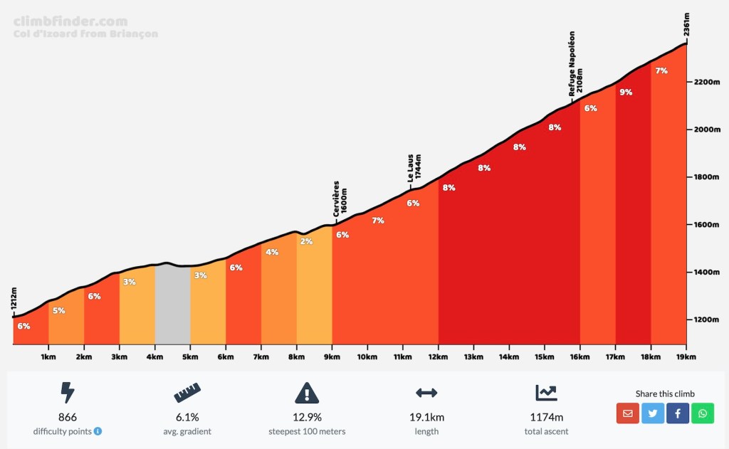
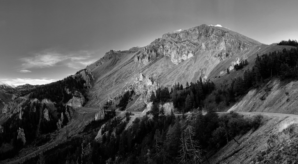
All thoughts of a problem with the route disappeared on a beautiful ascent of the Col d’Izoard, winding our way up through cloud and conifer forest that reached right up to the pass. The clouds that had been swirling about me lifted just as I arrived, revealing spectacular alpine scree slopes up close and rugged mountain peaks far away to the south. It felt like another magical day in the Alps unfolding.
Licking my lips for a speedy descent down this enticingly beautiful looking valley, three things were occupying my mind:
- escaping the cold
- 2nd breakfast at Guillestre
- beating the expected rain on the Col de Vars
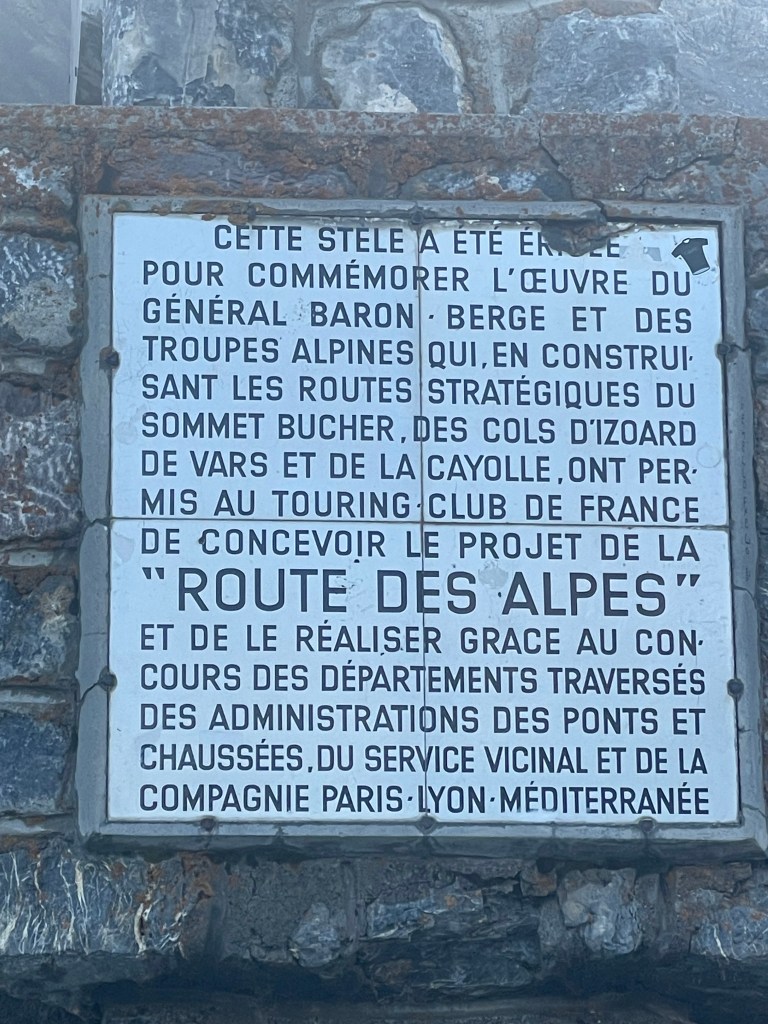
Ever the big picture person, I failed however to notice some of the important detail, i.e. the sign in the lower centre of the photo above which on closer inspection looks like this …
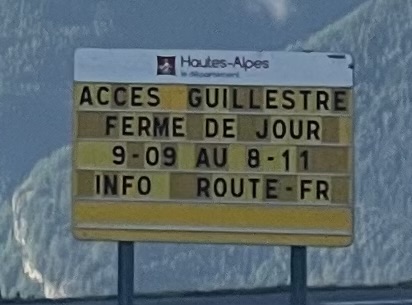
… which translates to “access Guillestre, closed during day, 9-09 to 8-11″ (same as the one in Briançon).
20 odd minutes later, 16km along and 1,100m lower in elevation, where the Torrent de l’lzoard meets the Guil, the road was blocked. First by a set of big red and white plastic blocks that giants mistake for lego lay in a line across the road – easily passed by bike. 50m further a large mesh fence spanning a bridge – a little more challenging but possible to squeeze past by dextrously hanging bikes over the rail.
Finally, a kilometre down the road a man with his van parked across the road gave us a clear ‘though shalt not pass’ kind of statement first in French, then in English just to be clear that there had been a landslide and the road was impassable.
There was to be no 2nd breakfast at Guillestre.
In this part of France the only options for getting to Barcelonnette were to go 200km via Italy and the 2,744m Colle d’Agnello plus the 1,996m Colle della Maddalena, or 120km back over the 2,360m Col d’Izoard and the 2,108m Col de Vars via Briançon.
So we called in the rescue team Liz and Sue who were already at the Col de Vars, who kindly drove back to the Col d’lzoard while we rode up a second time.

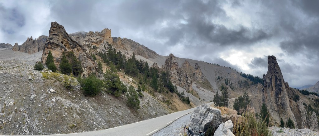
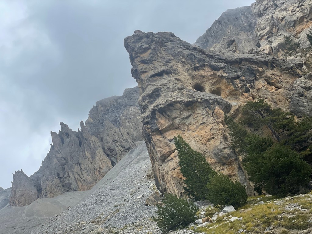
One consolation was getting a closer look at the Casse Déserte just below the pass on the upper south side, a forbidding and barren area with Cargneules or protruding pinnacles of weathered and ochre coloured limestone.
Among the scree slopes, they create a stark, lunar-like landscape that stands in contrast to the surrounding alpine scenery.
Arriving at the top before Sue and Liz, wanting to avoid waiting in the cold, the lack of traffic, and remembering what a beautiful road it was on the way up, I took the rapid descent and pick up in Briançon option.
I declined the option of being dropped off for the climb over the Col de Vars. By the time we got there, I had cooled down, the van was warm, there was a lot more traffic, it was starting to drizzle, it was getting on… you get the picture…
Intended Route
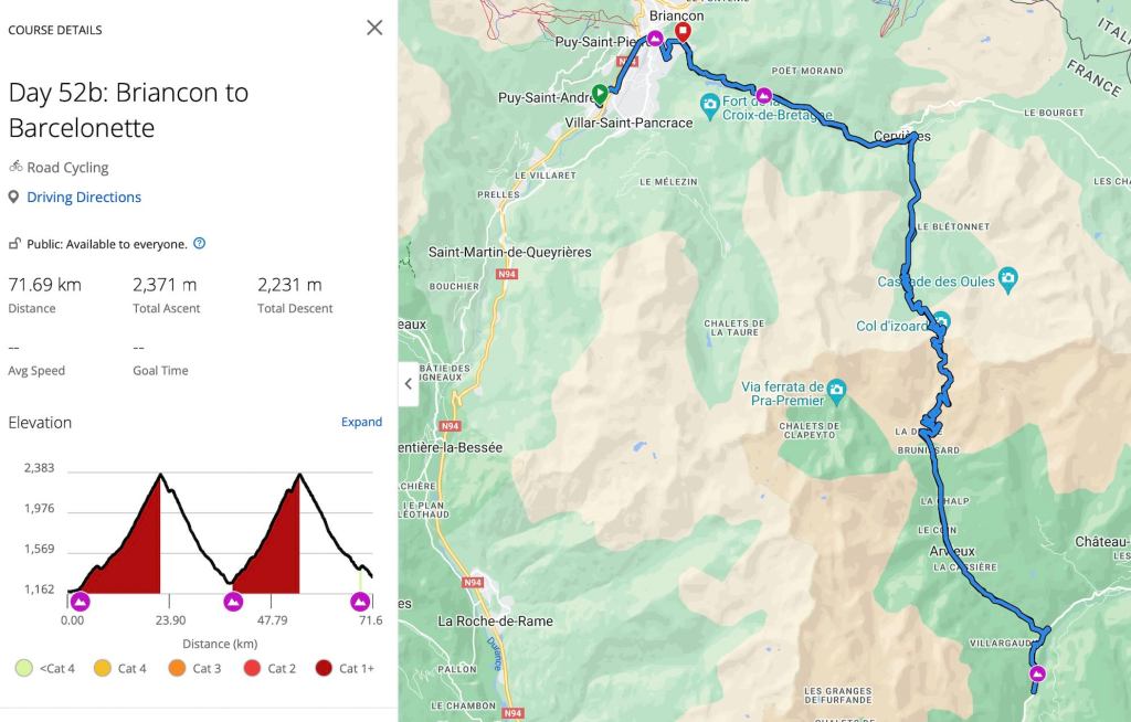
Actual Route

Leave a comment